
Tag: FHNW
7 posts tagged with "FHNW"
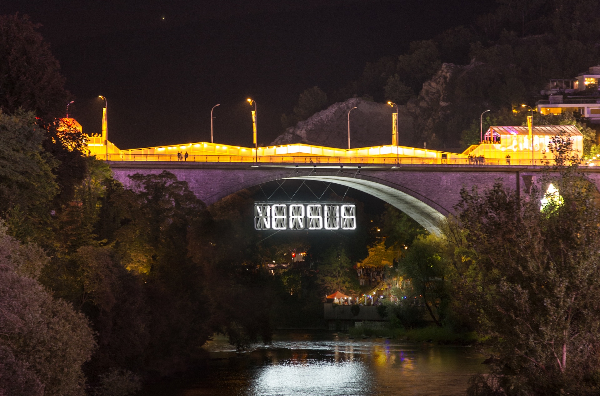
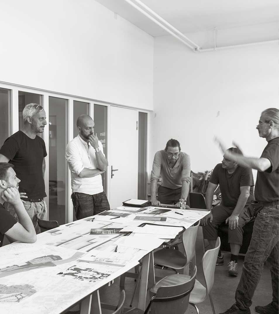
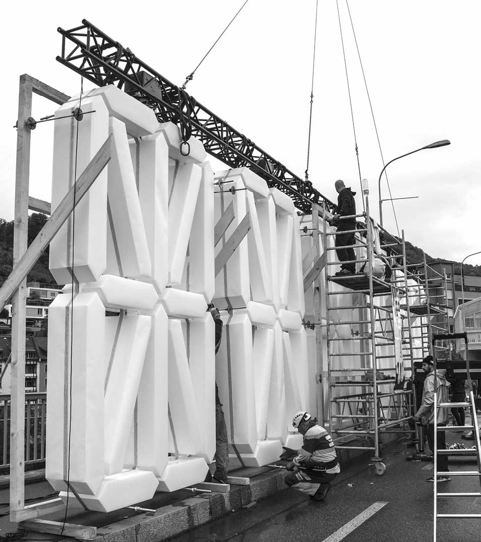
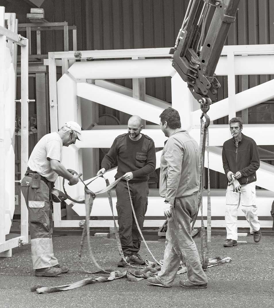
Versus
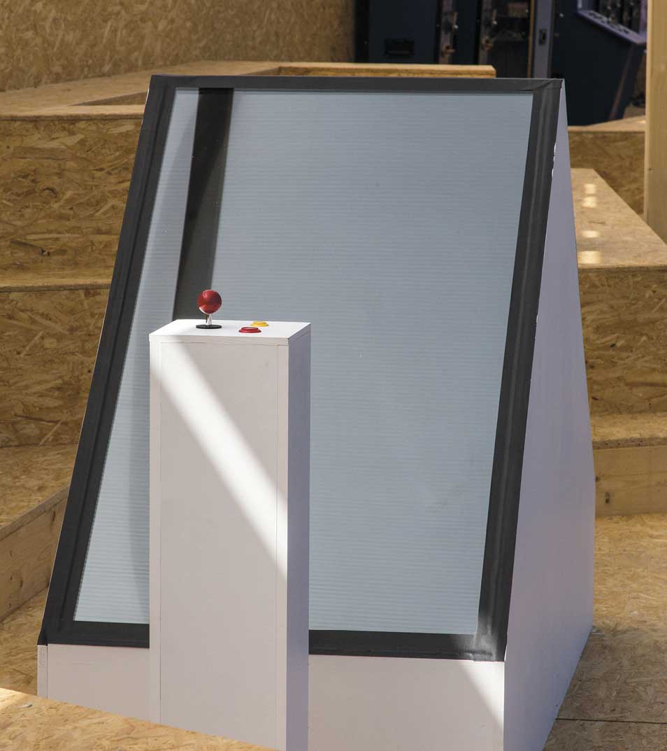
An 18m long and 4m high illuminated display hung in the middle of the bridge arch of the Hochbrücke Baden. It resembled an oversized LCD display, in six parts, like the word VERSUS, or a digital clock display: for hours, minutes, seconds. For 10 days it displayed words, so-called Versus pairs. These were pairs of words that shone in a regular cycle and synchronously above the Limmat in the directions north and south.
Only one word was readable at a time, or the opposing term shone in the opposite direction. The installation confronted the visitors with the festival theme of the Badenfahrt 2017 VERSUS and playfully challenged them to look for the contrast to the depicted word. The installation was loaded with a fund of over 100 pairs of opposites. Every visitor could play around these word pairs on the high bridge. Two games were specially developed for this purpose. Standing opposite each other, separated by the game console, they could compete against each other in the middle of a temporary permanent structure on the High Bridge.
The Versus pairs ranged from obvious opposites such as LOVE vs. HATE to „inseparable“ word pairs in which the opposites dissolved, e.g. PARKER vs. BARROW (surnames Bonnie & Clyde).
(by Matthias Gubler - thisisthis.ch/versus_installation)


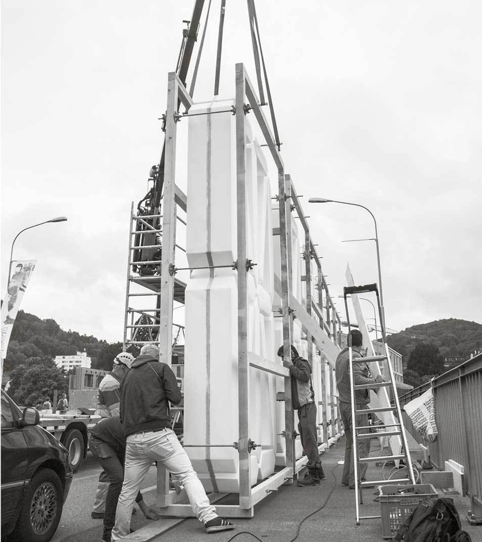
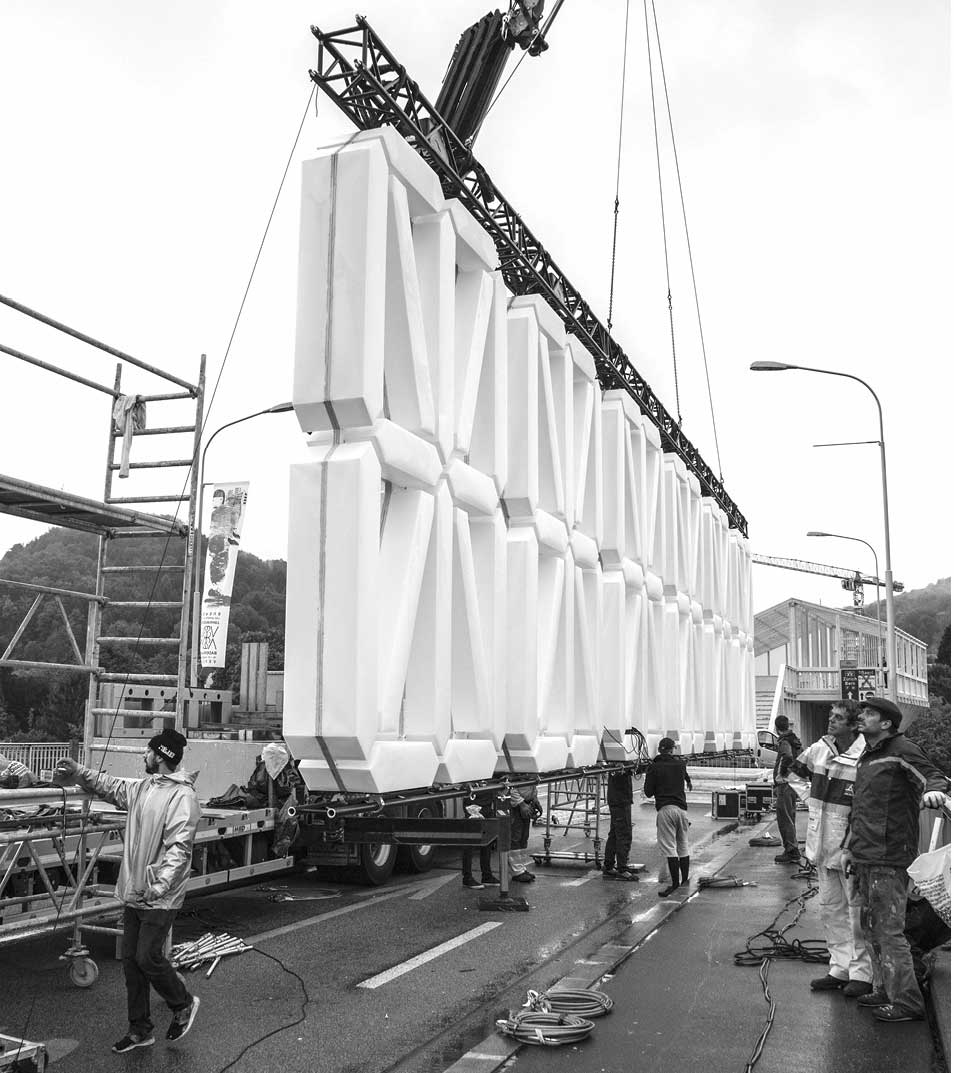
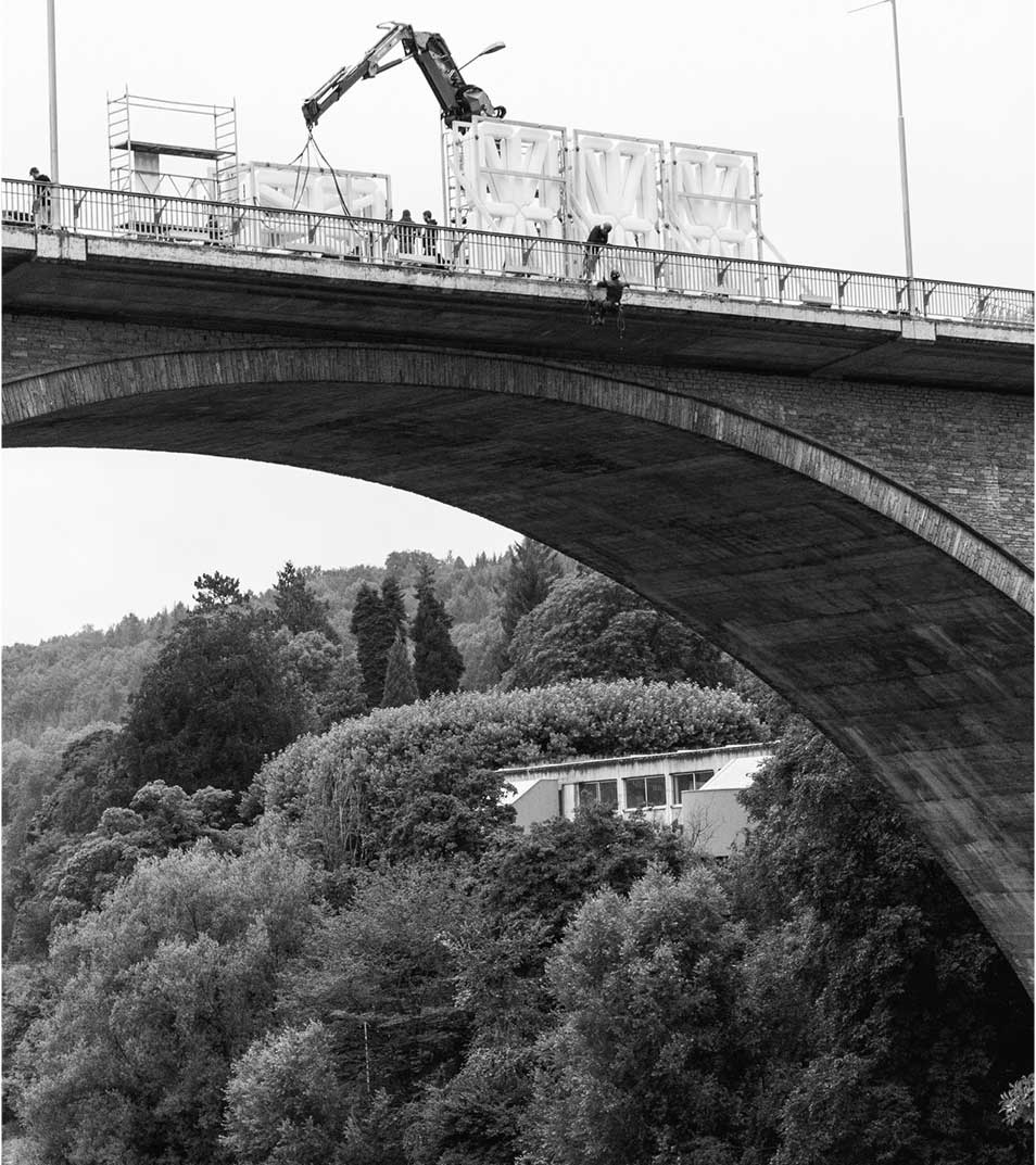
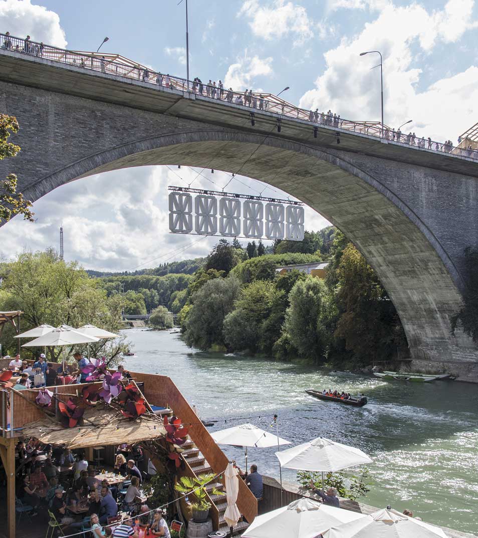
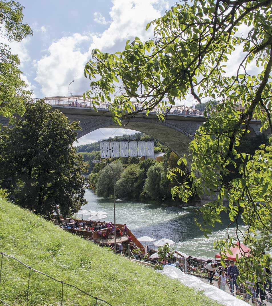
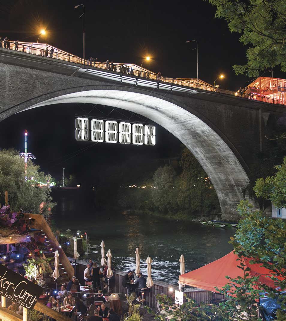
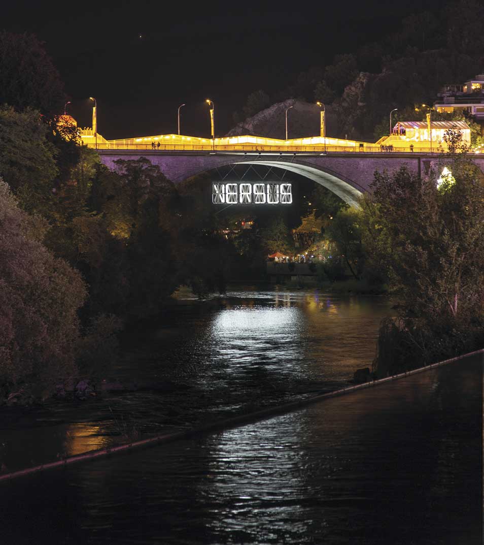
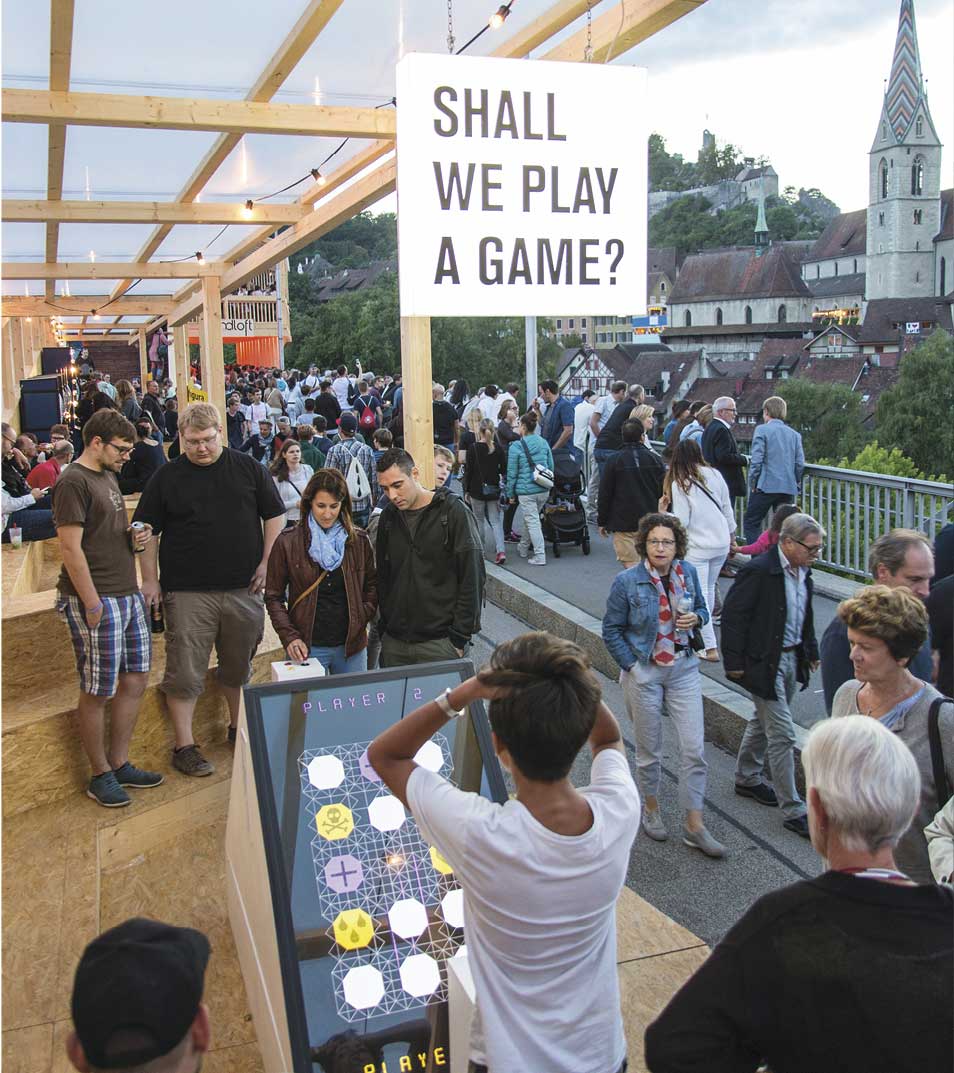
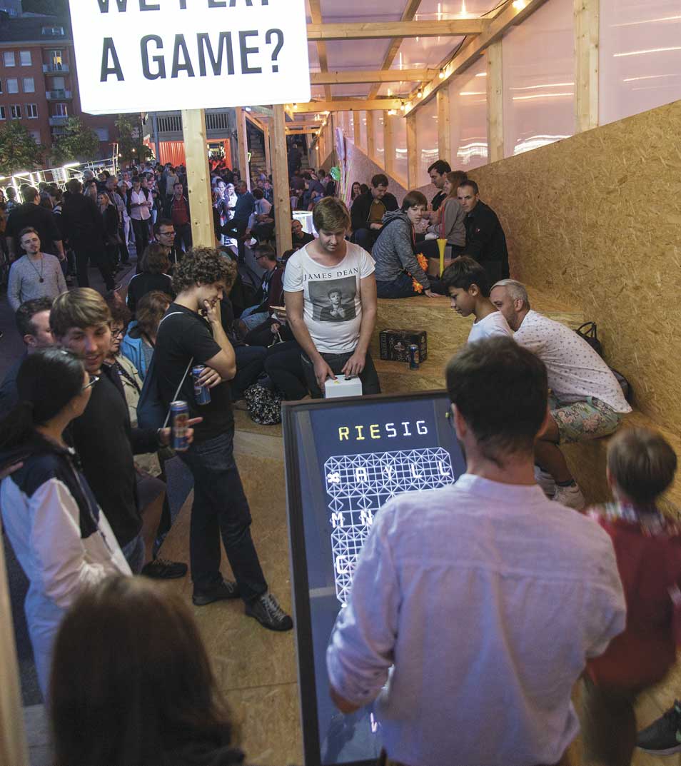
Exhibited at Badenfahrt, Baden, Switzerland, August - September 2017
3600 high power LEDs
14 km Cable
300m PVC-film
1.5 Tons
1800 × 400 × 60 cm
In collaboration with Matthias Gubler, Simon Schubiger, Filip Schramka, Cloé Hüsser, Tobias Baumgartner.
Supported by FHNW and BALTS.
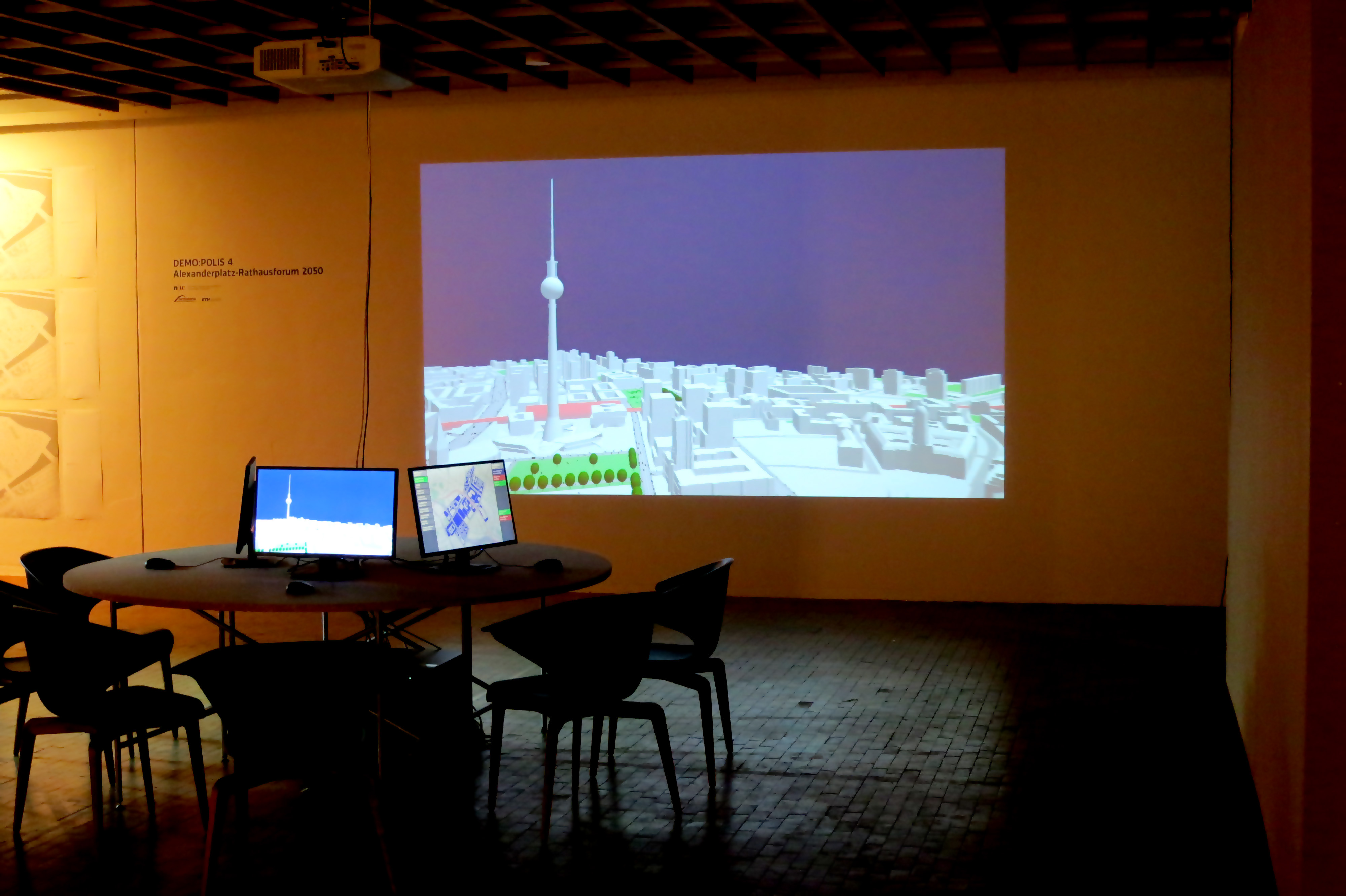
Enabling DEMO:POLIS
“Enabling DEMO:POLIS” is a participatory urban planning installation, presented as part of the DEMO:POLIS exhibition at the Berlin Akademie der Künste (https://www.adk.de/demopolis - 11.3.2016 - 29.5.2016). The installation engages the public in the design of open space and consists of six terminals that run a custom, interactive software application.
The software leads the user through a number of typical urban design tools (space allocation, streets, buildings, landscape, etc.) and concludes with a fly-through through the generated 3D scenario, in this case, the Rathausforum / Alexanderplatz area in Berlin.
The following video demonstrates a full cycle of a possible design.
Open Source
Source code, data and a binary build are available at: https://github.com/arisona
Credits
Concept: Stefan Arisona, Ruth Conroy Dalton, Christoph Hölscher, Wilfried Wang
Data & Coding: Stefan Arisona, Simon Schubiger, Zeng Wei
Support: Akademie der Künste Berlin, FHNW Switzerland (Institute of 4D Technologies), ETH Zürich (Future Cities Laboratory and Chair of Cognitive Science), Northumbria University (Architecture and Built Environment).
Data & Software Workflow
Enabling DEMO:POLIS builds on Open Data, in particular the publicly available 3D models of central Berlin provided by the Staatssenat für Stadtentwicklung und Umwelt (https://www.stadtentwicklung.berlin.de/planen/stadtmodelle/))
The original 3D models were initially imported into Autodesk AutoCAD for layer selection and coordinate system adjustments, then imported into Autodesk Maya for data cleaning and corrections. In a final step the data was imported into Esri CityEngine for final data adjustments & cleaning, merging, labelling, etc. The data was then exported as OBJs. The software application is written in Java, based on the 3D graphics library/engine ether. As indicated above, all source code and data is available as open source.
The Wild Jewels
Exhibition at the Institute for the Future (IFTF), Palo Alto, 21 September 2015 - 15 April 2016 as part of the Apocalypse Exhibition by Catherine Young
Pre-opening at swissnex San Francisco, 19 September 2015
Stefan Arisona, Simon Schubiger, in collaboration with Catherine Young
The Wild Jewels explore the possibilities of data-driven wearable technology that responds to future environmental scenarios. The pieces make use of data provided by millions of sensors and mobile phones that permanently collect data of the momentary state of a city; and in addition expand the scale to include solar activity data collected from observatories and probes in space.
The collection is inspired by large data analysis and collaboration facilities such as the Value Lab Asia, and it demonstrates typical modes of interaction with data: visualizing, filtering, projecting and connecting in a different context. Thereby, the pieces freely re-interpret and embody these modes, and bring them to a small, personal scale. The functional aspect is combined with precious materials and traditional jewelry and accessory designs, ultimately to be worn as pretty artworks.
Raumwetter (Space Weather Orb)
Raumwetter is a necklace that visualizes the beauty of space weather: The sun permanently releases streams of hot gas into space – the solar wind. A solar flare may blast millions of tons of matter into space, turning the wind into a storm reaching speeds of up to 2 million miles per hour. Luckily, on earth we are protected. Earth’s magnetic field redirects most charged solar particles to flow around the planet. However, space based technology (GPS), communication systems and power grids may be at risk. Thus, Raumwetter also has the capability to warn you of intense solar events.
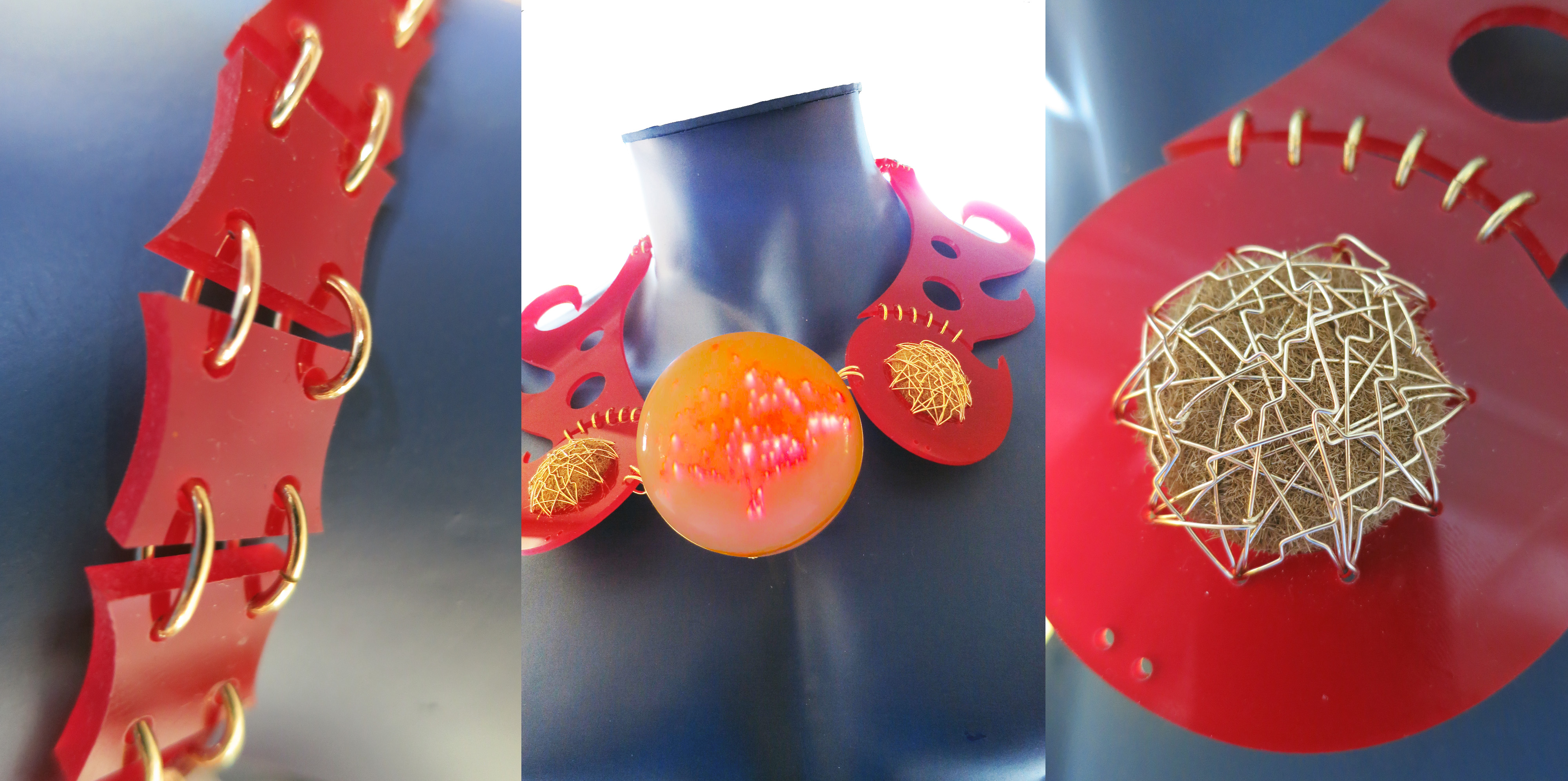 Raumwetter: Machine-cut acrylic; “patate di mare”; gold wire; transparent acrylic sphere, lit with pico-projector from inside.
Giftschleuse (Poison Gate Cuff)
On Earth, 780 million people do not have access to clean water, and in the near future, availability of water is expected to decrease in many regions. Giftschleuse is a water filtering bangle that can be worn at all times. It provides instant, clean water. Similarly to an exo-skeleton, it is an exo-organ that provides additional functions to the human body in situations where our own organism cannot deal with conditions such as polluted water. In addition, it maps areas of clean water and shares the data with other water-seekers nearby.
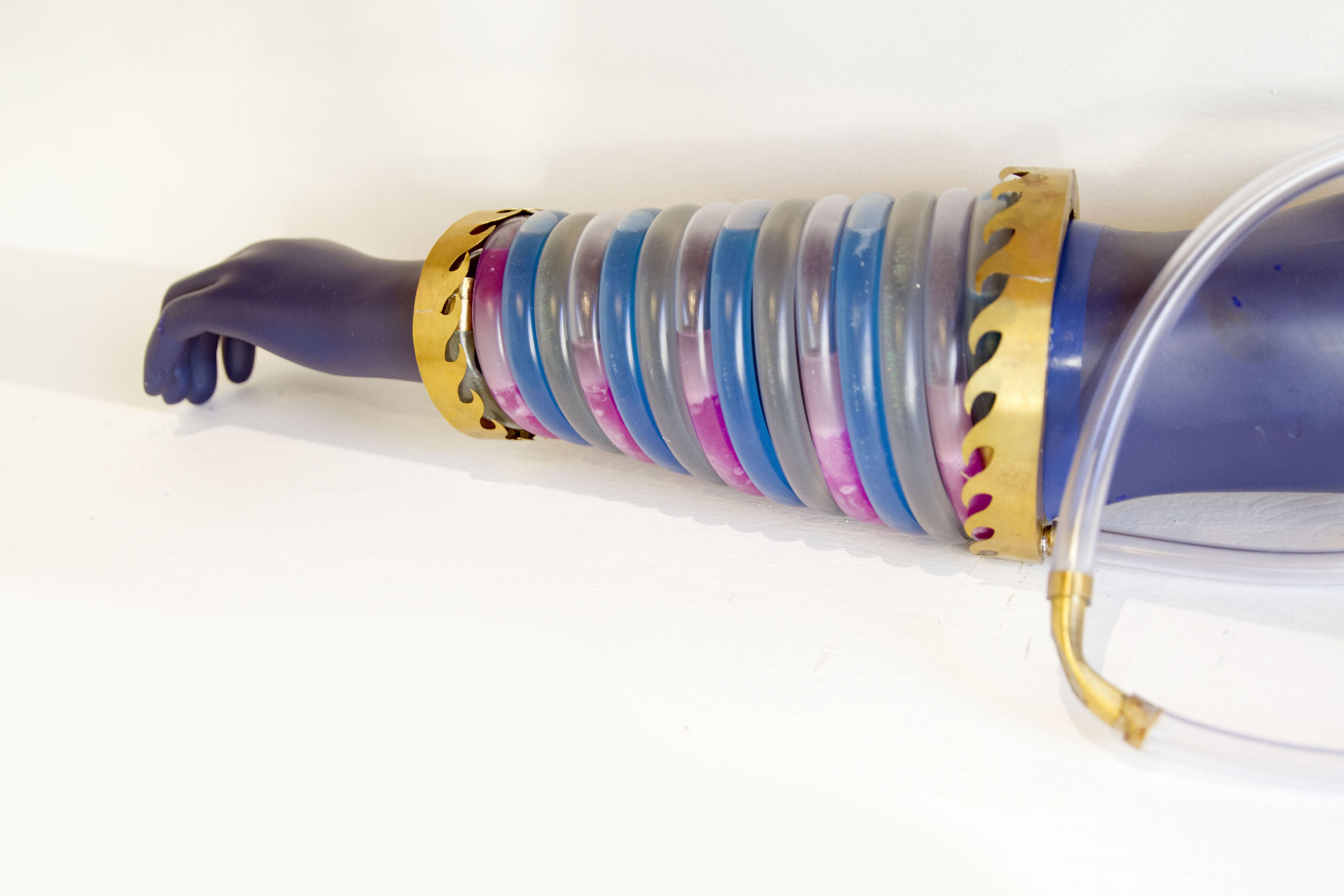 Giftschleuse: Machine cut brass, silicon pipes, coloured cooling liquid, electrical pumps.
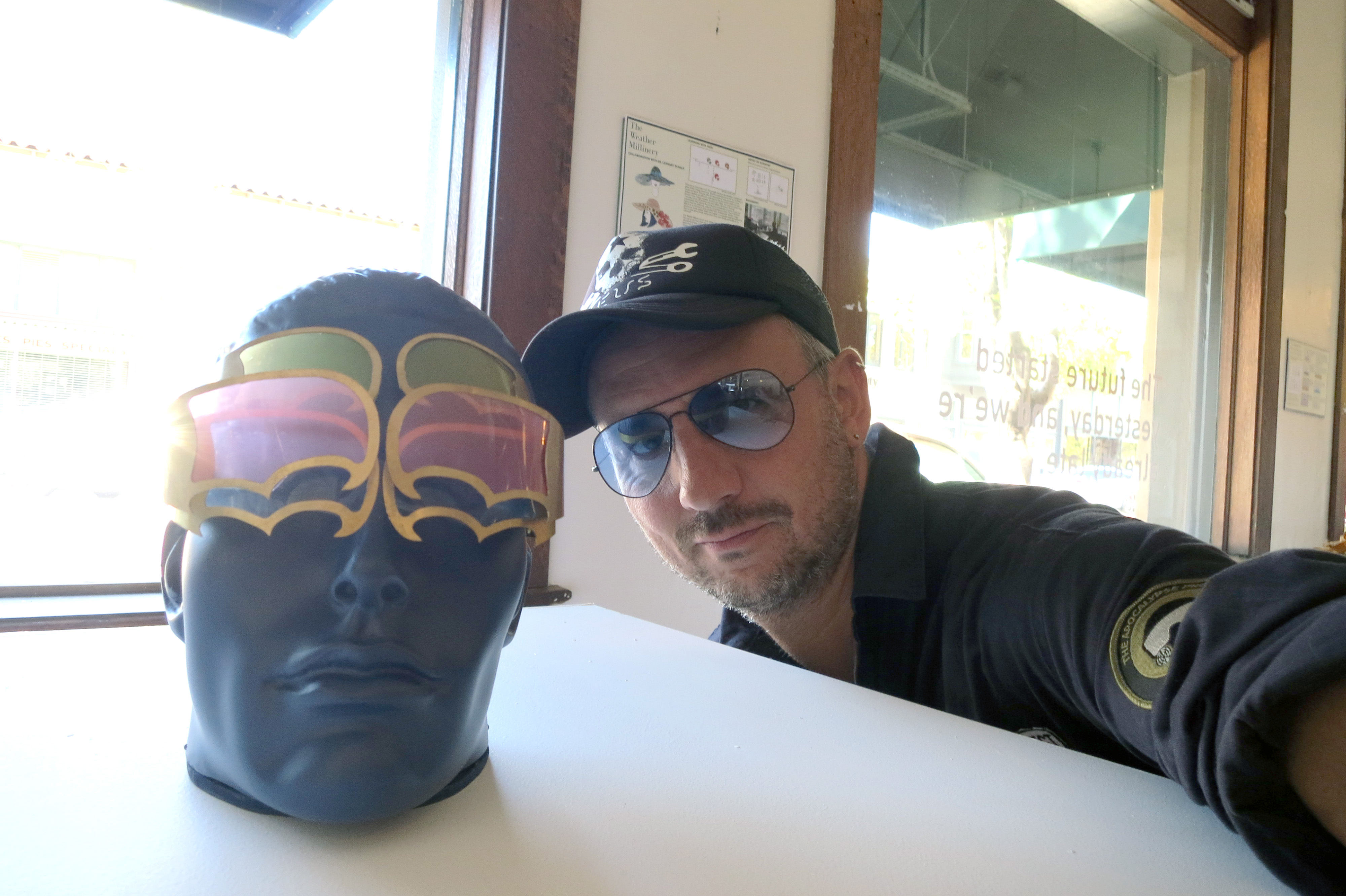
Durchblick (Clear Vision Goggles)
Besides correcting your seeing capabilities and protecting your eyes from strong light, Durchblick is a multifunctional display device that allows you to project the invisible into your visual perception: Depending on its configuration, it provides hints about wireless communication networks, radiation, dust and more. These are the shades for a hotter planet!
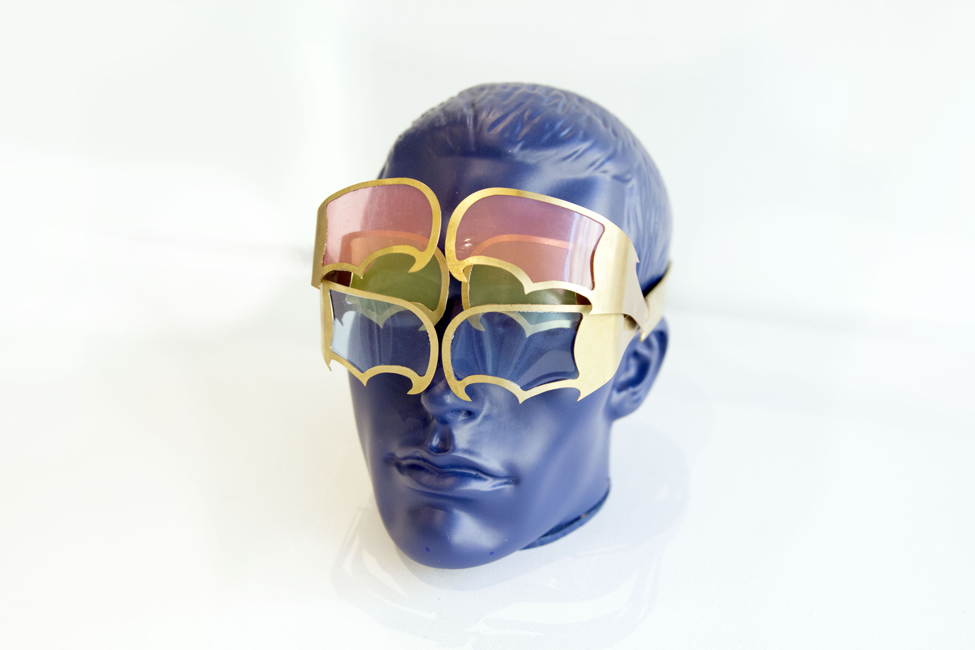 Durchblick: Machine-cut brass, acrylic glasses, motorised clock-work driving the shades.
Übergesund (Super Health Glove)
Übergesund is decorated glove and a social health device that builds spontaneous data networks with other wearers. It will inform you if somebody near you needs help, and it forwards such alerts to others around who might be able to help. In densely populated areas, such as in cities, Übergesund provides a decentralized health-network that allows for community-sourced services that are available at a high response time.
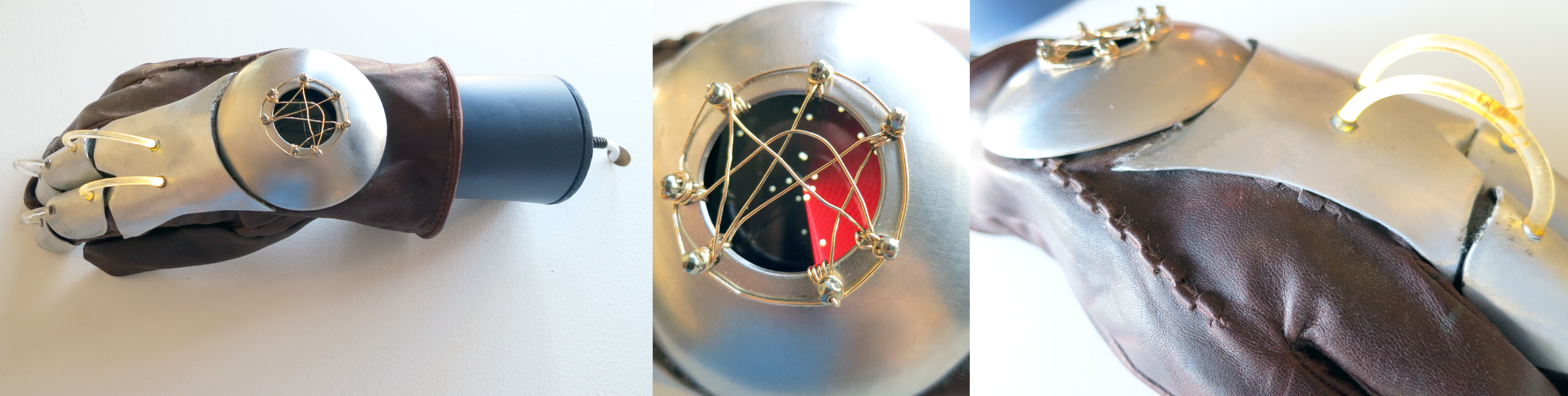 Übergesund: Cut, turned and brushed steel; gold wire; silicon LED strings; custom-programmed smart watch LCD display.
This work was supported by: ETH Zürich (ETH Global & Future Cities Laboratory), FHNW (Institute of 4D Technologies), Institute for the Future, swissnex San Francisco, Consulate General of Switzerland in San Francisco.

More infos on the Apocalypse Project: https://apocalypse.cc
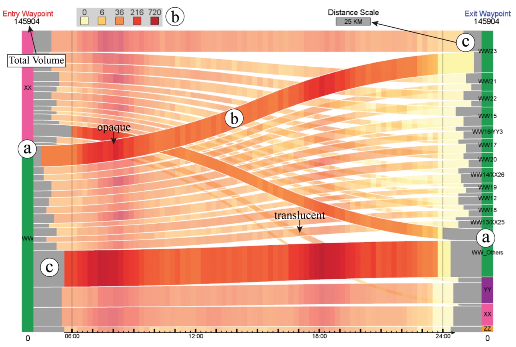
Visualizing Waypoints-Constrained Origin-Destination Patterns for Massive Transportation Data (CGF)
Journal: Computer Graphics Forum
Authors: Wei Zeng, Chi-Wing Fu, Stefan Arisona, Alexander Erath, Huamin Qu
Abstract: Origin-destination (OD) pattern is a highly useful means for transportation research since it summarizes urban dynamics and human mobility. However, existing visual analytics are insufficient for certain OD analytical tasks needed in transport research. For example, transport researchers are interested in path-related movements across congested roads, besides global patterns over the entire domain. Driven by this need, we propose waypoints-constrained OD visual analytics, a new approach for exploring path-related OD patterns in an urban transportation network. First, we use hashing-based query to support interactive filtering of trajectories through user-specified waypoints. Second, we elaborate a set of design principles and rules, and derive a novel unified visual representation called the waypoints-constrained OD view by carefully considering the OD flow presentation, the temporal variation, spatial layout and user interaction. Finally, we demonstrate the effectiveness of our interface with two case studies and expert interviews with five transportation experts.
Title: Visualizing Waypoints-Constrained Origin-Destination Patterns for Massive Transportation Data
Authors: Wei Zeng, Chi-Wing Fu, Stefan Arisona, Alexander Erath, Huamin Qu
Journal: Computer Graphics Forum
Publisher: Eurographics Association
Year: 2015
Link: https://dx.doi.org/10.1111/cgf.12778
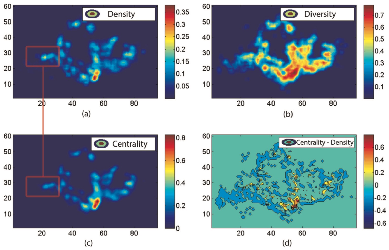
Revealing Centrality in the Spatial Structure of Cities from Human Activity Patterns (Urban Studies)
Journal: Urban Studies
Authors: Chen Zhong, Markus Schläpfer, Stefan Arisona, Michael Batty, Carlo Ratti, Gerhard Schmitt
Abstract: Identifying changes in the spatial structure of cities is a prerequisite for the development and vali- dation of adequate planning strategies. Nevertheless, current methods of measurement are becoming ever more challenged by the highly diverse and intertwined ways of how people actually make use of urban space. Here, we propose a new quantitative measure for the centrality of locations, taking into account not only the numbers of people attracted to different locations, but also the diversity of the activities they are engaged in. This ‘centrality index’ allows for the identifi- cation of functional urban centres and for a systematic tracking of their relative importance over time, thus contributing to our understanding of polycentricity. We demonstrate the proposed index using travel survey data in Singapore for different years between 1997 and 2012. It is shown that, on the one hand, the city-state has been developing rapidly towards a polycentric urban form that compares rather closely with the official urban development plan. On the other hand, however, the downtown core has strongly gained in its importance, and this can be partly attrib- uted to the recent extension of the public transit system.
Title: Time-Space Diagram Revisited
Authors: Chen Zhong, Markus Schläpfer, Stefan Arisona, Michael Batty, Carlo Ratti, Gerhard Schmitt
Journal: Urban Studies
Publisher: Sage
Year: 2015
Link: https://dx.doi.org/10.1177/0042098015601599