Tag Archives: Featured

Detecting the Dynamics of Urban Structure Through Spatial Network Analysis (IJGIS 2014)

Journal: International Journal of Geographical Information Science

Authors: Chen Zhong, Stefan Müller Arisona, Xianfeng Huang, Michael Batty, Gerhard Schmitt

Abstract: Urban spatial structure in large cities is becoming ever more complex as populations grow in size, engage in more travel, and have increasing amounts of disposable income that enable them to live more diverse lifestyles. These trends have prominent and visible effects on urban activity, and cities are becoming more polycentric in their structure as new clusters and hotspots emerge and coalesce in a wider sea of urban development. Here, we apply recent methods in network science and their generalization to spatial analysis to identify the spatial structure of city hubs, centers, and borders, which are essential elements in understanding urban interactions. We use a ‘big’ data set for Singapore from the automatic smart card fare collection system, which is available for sample periods in 2010, 2011, and 2012 to show how the changing roles and influences of local areas in the overall spatial structure of urban movement can be efficiently monitored from daily transportation.
In essence, we first construct a weighted directed graph from these travel records. Each node in the graph denotes an urban area, edges denote the possibility of travel between any two areas, and the weight of edges denotes the volume of travel, which is the number of trips made. We then make use of (a) the graph properties to obtain an overall view of travel demand, (b) graph centralities for detecting urban centers and hubs, and (c) graph community structures for uncovering socioeconomic clusters defined as neighborhoods and their borders. Finally, results of this network analysis are projected back onto geographical space to reveal the spatial structure of urban movements. The revealed community structure shows a clear subdivision into different areas that separate the population’s activity space into smaller neighborhoods. The generated borders are different from existing administrative ones. By comparing the results from 3 years of data, we find that Singapore, even from such a short time series, is developing rapidly towards a polycentric urban form, where new subcenters and communities are emerging largely in line with the city’s master plan.
To summarize, our approach yields important insights into urban phenomena generated by human movements. It represents a quantitative approach to urban analysis, which explicitly identifies ongoing urban transformations.

Title: Detecting the Dynamics of Urban Structure Through Spatial Network Analysis
Authors: Chen Zhong, Stefan Müller Arisona, Xianfeng Huang, Michael Batty, Gerhard Schmitt
Journal: International Journal of Geographical Information Science
Publisher: Taylor & Francis
Year: 2014
DOI: 10.1080/13658816.2014.914521
Link: http://www.tandfonline.com/doi/abs/10.1080/13658816.2014.914521#.U8P6N1bsd8E

Multi-Projector-Mapper (MPM): Open-Source 3D Projection Mapping Software Framework

The multi-projector-mapper (MPM) is an open-source software framework for 3D projection mapping using multiple projectors. It contains a basic rendering infrastructure, and interactive tools for projector calibration. For calibration, the method given in Oliver Bimber and Ramesh Raskar’s book Spatial Augmented Reality, Appendix A, is used. Continue reading

Digital Art Weeks Singapore

As we are working hard on the preparations for Digital Art Weeks 2013, which will take place in Singapore in May 2013, our new DAW Facebook page is now online at:

https://www.facebook.com/DigitalArtWeeks

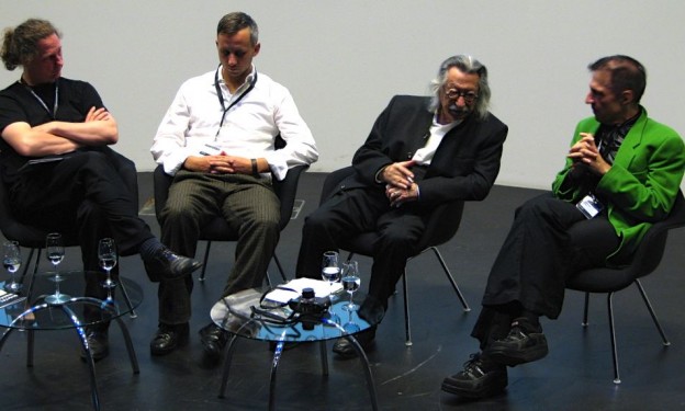
The page contains lots of materials from previous DAWs. The featured picture above is from DAW 2007 in Zurich, with Computer Pioneer and Rebel at Work Joseph Weizenbaum, ETH Professor Jürg Gutknecht, Art Clay and me, during a panel at ETH Zurich’s VisDome.

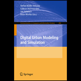
Book: Digital Urban Modeling and Simulation

Edited by Stefan Müller Arisona, Gideon Aschwanden, Jan Halatsch, and Peter Wonka, 2012

About this Book

This book is thematically positioned at the intersections of Urban Design, Architecture, Civil Engineering and Computer Science, and it has the goal to provide specialists coming from respective fields a multi-angle overview of state-of-the-art work currently being carried out. It addresses both newcomers who wish to obtain more knowledge about this growing area of interest, as well as established researchers and practitioners who want to keep up to date. In terms of organization, the volume starts out with chapters looking at the domain at a wide-angle and then moves focus towards technical viewpoints and approaches. (Excerpt from preface by Stefan Müller Arisona). Continue reading

The Value Lab Asia

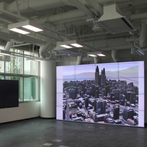
The Value Lab Asia is a collaborative, digitally augmented environment for a wide range of applications, such as participatory urban planning and design, stakeholder communication, information visualisation and discovery, remote teaching and conferencing. It includes a 33 megapixel video wall, three large displays with touch overlays, a number of smaller, mobile multi-touch enabled displays, and extensive video conferencing capabilities. The Value Lab Asia is the younger sibling of the Value Lab Zurich, built at ETH Zurich’s ScienceCity by Gerhard Schmitt, Remo Burkhard, Jan Halatsch and Antje Kunze of the Chair of Information Architecture in 2007/08. It therefore borrows many of the concepts of the Value Lab Zurich, such as being set in a friendly environment that operates in daylight conditions, however comes with updated state-of-the-art hardware and a different look. Continue reading

robot_mixeur

‘robot_mixeur’ is my alter ego when performing as visualist and DJ. As a DJ, I usually mix elements from minimal techno, tech house and techno into driving soundscapes and pushing beats. As a visualist (or VJ), I am using the self-coded software Soundium/Decklight as performance environment for live video editing and 3D content generation. Continue reading